
Thank you for supporting this site ❤️
Make a donation
Make a donation
Gear up for your next adventure:
As an Amazon Associate, this site earns from qualifying purchases at no extra cost to you.
Ördekli topographic map
Click on the map to display elevation.
Thank you for supporting this site ❤️
Make a donation
Make a donation
Gear up for your next adventure:
As an Amazon Associate, this site earns from qualifying purchases at no extra cost to you.
About this map
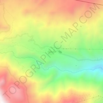
Name: Ördekli topographic map, elevation, terrain.
Location: Ördekli, Hakkâri, Région de l'Anatolie orientale, Turquie (37.72417 43.72690 37.76417 43.76690)
Average elevation: 2,567 m
Minimum elevation: 1,915 m
Maximum elevation: 3,214 m
Thank you for supporting this site ❤️
Make a donation
Make a donation
Gear up for your next adventure:
As an Amazon Associate, this site earns from qualifying purchases at no extra cost to you.