
Thank you for supporting this site ❤️
Make a donation
Make a donation
Gear up for your next adventure:
As an Amazon Associate, this site earns from qualifying purchases at no extra cost to you.
Kimandi topographic map
Click on the map to display elevation.
Thank you for supporting this site ❤️
Make a donation
Make a donation
Gear up for your next adventure:
As an Amazon Associate, this site earns from qualifying purchases at no extra cost to you.
About this map
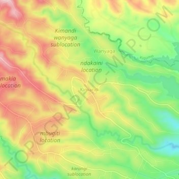
Name: Kimandi topographic map, elevation, terrain.
Location: Kimandi, Kariara ward, Gatanga, Murang'a County, Kenya (-0.84054 36.79102 -0.80054 36.83102)
Average elevation: 2,104 m
Minimum elevation: 1,971 m
Maximum elevation: 2,235 m
Thank you for supporting this site ❤️
Make a donation
Make a donation
Gear up for your next adventure:
As an Amazon Associate, this site earns from qualifying purchases at no extra cost to you.