Geolocate

Randazzo topographic map

Click on the map to display elevation.

About this map
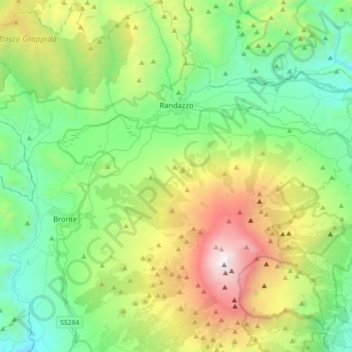
Name: Randazzo topographic map, elevation, terrain.

Location: Randazzo, Catania, Sicily, 95036, Italy (37.68089 14.70573 37.96111 15.02400)

Average elevation: 1,143 m

Minimum elevation: 275 m

Maximum elevation: 3,313 m

Other topographic maps

Click on a map to view its topography, its elevation and its terrain.

Nicolosi Nord

Italy > Sicily > Catania > Nicolosi

Average elevation: 1,915 m

Gear up for your next adventure:

🧴Bear Spray Holster - Quick-access carry for essential Canadian wilderness safety
💡LED Headlamp - Hands-free illumination for night hiking and camping
💧Collapsible Water Bottle - Space-saving water bottle for outdoor activities
💡Solar Camping Lamp - Eco-friendly lighting for campsites
🥫Freeze-Dried Meals - Lightweight, high-calorie nutrition for multi-day treks

As an Amazon Associate, this site earns from qualifying purchases at no extra cost to you.