Geolocate

Hardware topographic map

Click on the map to display elevation.

About this map

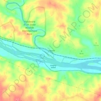
Name: Hardware topographic map, elevation, terrain.

Location: Hardware, Fluvanna County, Virginia, United States (37.72292 -78.42556 37.76292 -78.38556)

Average elevation: 105 m

Minimum elevation: 69 m

Maximum elevation: 145 m

Other topographic maps

Click on a map to view its topography, its elevation and its terrain.

Columbia

United States > Virginia > Fluvanna County

Average elevation: 78 m

Gear up for your next adventure:

🧶550 Survival Paracord - Versatile utility cord for emergency repairs and rigging
🥾Hiking Gaiters - Protect legs and shoes from mud, snow, and debris
🧥Waterproof Hiking Jacket - Protect yourself from rain and wind while hiking
❄️Traction Ice Cleats - Slip-on spikes for icy trails and winter hiking
🎒Backpack Rain Cover - External shield to keep your entire pack dry

As an Amazon Associate, this site earns from qualifying purchases at no extra cost to you.