Geolocate

Kappel topographic map

Click on the map to display elevation.

About this map

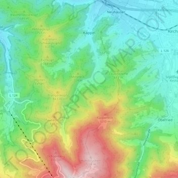
Name: Kappel topographic map, elevation, terrain.

Location: Kappel, Freiburg im Breisgau, Baden-Württemberg, Germany (47.91192 7.88044 47.97646 7.92492)

Average elevation: 635 m

Minimum elevation: 337 m

Maximum elevation: 1,275 m

Other topographic maps

Click on a map to view its topography, its elevation and its terrain.

Gear up for your next adventure:

🥾Trekking Poles - Adjustable trekking poles to reduce knee stress and improve stability
🧢Beanie Hat - Keep your head warm in cold weather
🍽️Titanium Camping Spork - Ultralight and indestructible eating utensil
🧥Softshell Hiking Jacket - The perfect balance of wind protection and breathability
🎒Hiking Daypack - Lightweight and durable backpacks for day trips and excursions

As an Amazon Associate, this site earns from qualifying purchases at no extra cost to you.