Geolocate

Granite Island topographic map

Click on the map to display elevation.

About this map

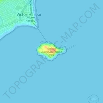
Name: Granite Island topographic map, elevation, terrain.

Location: Granite Island, City of Victor Harbor, South Australia, Australia (-35.56676 138.62582 -35.56195 138.63833)

Average elevation: 1 m

Minimum elevation: 0 m

Maximum elevation: 37 m

Other topographic maps

Click on a map to view its topography, its elevation and its terrain.

Gear up for your next adventure:

🥾Mountain Trail Shoes - High-traction shoes for mountain trails
🌡️Emergency Mylar Blankets - Compact thermal protection for unexpected nights outdoors
🥾Durable Hiking Shoes - Long-lasting shoes for frequent hiking
🛌Insulated Sleeping Pad - Critical thermal barrier between you and the cold ground
🥾Waterproof Hiking Shoes - Durable shoes for wet and rugged trails

As an Amazon Associate, this site earns from qualifying purchases at no extra cost to you.