Geolocate

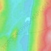
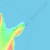
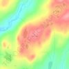
Burlington topographic map

Click on the map to display elevation.

About this map

Name: Burlington topographic map, elevation, terrain.

Location: Burlington, Newfoundland, Newfoundland and Labrador, Canada (49.73449 -56.03270 49.76025 -55.99190)

Average elevation: 28 m

Minimum elevation: -2 m

Maximum elevation: 219 m

Other topographic maps

Click on a map to view its topography, its elevation and its terrain.
Labrador

Canada > Newfoundland and Labrador

Average elevation: 674 m

Englee

Canada > Newfoundland and Labrador > Englee

Average elevation: 34 m

Mount Caubvick

Canada > Newfoundland and Labrador

Average elevation: 1,272 m

Bridgeport

Canada > Newfoundland and Labrador

Average elevation: 22 m

Monroe

Canada > Newfoundland and Labrador

Average elevation: 41 m

Smokey

Canada > Newfoundland and Labrador > Smokey

Average elevation: 14 m

Tims Hill

Canada > Newfoundland and Labrador

Average elevation: 126 m

Gear up for your next adventure:

⛺Backpacking Tent - Lightweight tent for long-distance hiking trips
🥾All-Terrain Hiking Boots - Versatile boots for varied hiking conditions
👟Trail Running Shoes - Agile footwear for fast-paced topographic exploration
🦯Trekking Poles - Reduced impact on joints for steep topographic climbs
🧭GPS Outdoor Watch - Smart watch for navigation and fitness tracking in nature

As an Amazon Associate, this site earns from qualifying purchases at no extra cost to you.