
Thank you for supporting this site ❤️
Make a donation
Make a donation
Gear up for your next adventure:
As an Amazon Associate, this site earns from qualifying purchases at no extra cost to you.
Seeblick topographic map
Click on the map to display elevation.
Thank you for supporting this site ❤️
Make a donation
Make a donation
Gear up for your next adventure:
As an Amazon Associate, this site earns from qualifying purchases at no extra cost to you.
About this map
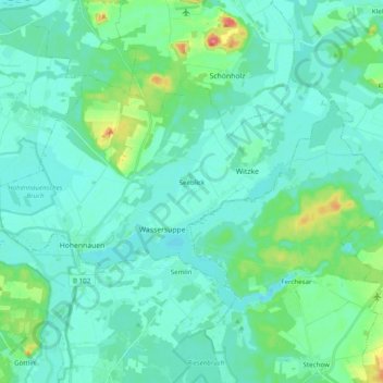
Name: Seeblick topographic map, elevation, terrain.
Location: Seeblick, Rhinow, Havelland, Brandenburg, Deutschland (52.64752 12.26872 52.71984 12.46460)
Average elevation: 33 m
Minimum elevation: 21 m
Maximum elevation: 89 m
Thank you for supporting this site ❤️
Make a donation
Make a donation
Gear up for your next adventure:
As an Amazon Associate, this site earns from qualifying purchases at no extra cost to you.