Geolocate

Roorki topographic map

Click on the map to display elevation.

About this map

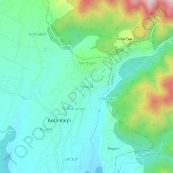
Name: Roorki topographic map, elevation, terrain.

Location: Roorki, Kaladhungi, Nainital, Uttarakhand, India (29.36431 79.30678 29.40431 79.34678)

Average elevation: 698 m

Minimum elevation: 542 m

Maximum elevation: 1,151 m

Gear up for your next adventure:

🧦Merino Wool Socks - Moisture-wicking comfort for long-distance hiking
🧥Fleece Jacket - Warm and lightweight jacket for layering
🌡️Emergency Mylar Blankets - Compact thermal protection for unexpected nights outdoors
🔋Emergency Crank Radio - Weather alerts and power without needing batteries
🧦Outdoor Socks - Durable socks designed for hiking and outdoor sports

As an Amazon Associate, this site earns from qualifying purchases at no extra cost to you.