
Gandhinagar topographic map
Interactive map
Click on the map to display elevation.
About this map
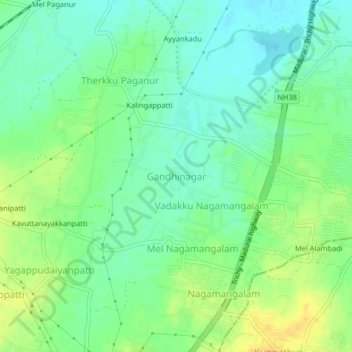
Name: Gandhinagar topographic map, elevation, terrain.
Average elevation: 94 m
Minimum elevation: 83 m
Maximum elevation: 108 m
Other topographic maps
Click on a map to view its topography, its elevation and its terrain.
Mallachipuram
Inde > Tamil Nadu > Srirangam > Mallachipuram
Mallachipuram, Srirangam, Tiruchirappalli District, Tamil Nadu, 620006, Inde
Average elevation: 71 m