
Thank you for supporting this site ❤️
Make a donation
Make a donation
Gear up for your next adventure:
As an Amazon Associate, this site earns from qualifying purchases at no extra cost to you.
Jedburgh topographic map
Click on the map to display elevation.
Thank you for supporting this site ❤️
Make a donation
Make a donation
Gear up for your next adventure:
As an Amazon Associate, this site earns from qualifying purchases at no extra cost to you.
About this map
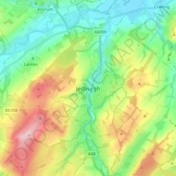
Name: Jedburgh topographic map, elevation, terrain.
Location: Jedburgh, Scottish Borders, Scotland, TD8 6AP, United Kingdom (55.43764 -2.59538 55.51764 -2.51538)
Average elevation: 151 m
Minimum elevation: 50 m
Maximum elevation: 338 m
Thank you for supporting this site ❤️
Make a donation
Make a donation
Gear up for your next adventure:
As an Amazon Associate, this site earns from qualifying purchases at no extra cost to you.