Geolocate

Snead topographic map

Click on the map to display elevation.

About this map

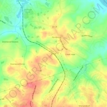
Name: Snead topographic map, elevation, terrain.

Location: Snead, Columbia County, Georgia, United States (33.54569 -82.14067 33.58569 -82.10067)

Average elevation: 88 m

Minimum elevation: 52 m

Maximum elevation: 122 m

Other topographic maps

Click on a map to view its topography, its elevation and its terrain.

Evans

United States > Georgia > Columbia County

Average elevation: 116 m

Harlem

United States > Georgia > Columbia County

Average elevation: 148 m

Gear up for your next adventure:

💧Filtered Water Bottle - Safe drinking water on the go
🦯Trekking Poles - Reduced impact on joints for steep topographic climbs
🧢Hiking Sun Hat - Wide-brimmed protection for exposed mountain ridges
🧢Outdoor Cap - Protective cap for sun and rain during hikes
🧭GPS Handheld Device - Reliable GPS navigation for outdoor adventures

As an Amazon Associate, this site earns from qualifying purchases at no extra cost to you.