Geolocate

Zacualtipán topographic map

Click on the map to display elevation.

About this map

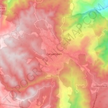
Name: Zacualtipán topographic map, elevation, terrain.

Location: Zacualtipán, Zacualtipán de Ángeles, Hidalgo, 43200, Mexico (20.60979 -98.69633 20.68979 -98.61633)

Average elevation: 1,933 m

Minimum elevation: 1,253 m

Maximum elevation: 2,233 m

Gear up for your next adventure:

🧭GPS Outdoor Watch - Smart watch for navigation and fitness tracking in nature
🥾Hiking Leggings - Comfortable leggings for outdoor activities
🧦Crew Hiking Socks - Comfortable socks for long-distance hikes
🥾Durable Hiking Shoes - Long-lasting shoes for frequent hiking
🥾Lightweight Hiking Shoes - Comfortable shoes for day hikes

As an Amazon Associate, this site earns from qualifying purchases at no extra cost to you.