
Thank you for supporting this site ❤️
Make a donation
Make a donation
Gear up for your next adventure:
As an Amazon Associate, this site earns from qualifying purchases at no extra cost to you.
Cuchapampa topographic map
Click on the map to display elevation.
Thank you for supporting this site ❤️
Make a donation
Make a donation
Gear up for your next adventure:
As an Amazon Associate, this site earns from qualifying purchases at no extra cost to you.
About this map
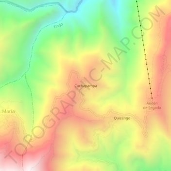
Name: Cuchapampa topographic map, elevation, terrain.
Location: Cuchapampa, Tingo, Province of Luya, Amazonas, Peru (-6.44337 -77.96216 -6.40337 -77.92216)
Average elevation: 2,681 m
Minimum elevation: 2,050 m
Maximum elevation: 3,316 m
Thank you for supporting this site ❤️
Make a donation
Make a donation
Gear up for your next adventure:
As an Amazon Associate, this site earns from qualifying purchases at no extra cost to you.