
Make a donation
Gear up for your next adventure:
As an Amazon Associate, this site earns from qualifying purchases at no extra cost to you.
Satzung topographic map
Click on the map to display elevation.
Make a donation
Gear up for your next adventure:
As an Amazon Associate, this site earns from qualifying purchases at no extra cost to you.
Satzung
1910 wurde Satzung anerkannter Höhenluftkurort, 1915 erhielt er Anschluss an das Elektrizitätsnetz. In der Folge wurden 1927 eine Zufahrt zum Hirtstein und eine Bergbaude errichtet. Einen Rathausneubau erhielt der Ort 1939. Im März 1944 war der Ort durch heftige Schneefälle mit Verwehungen von der Außenwelt abgeschnitten, lediglich eine Versorgung aus der Luft war möglich.
Make a donation
Gear up for your next adventure:
As an Amazon Associate, this site earns from qualifying purchases at no extra cost to you.
About this map
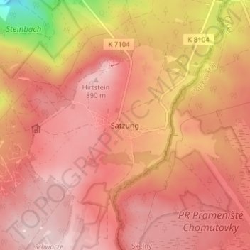
Name: Satzung topographic map, elevation, terrain.
Location: Satzung, Marienberg, Erzgebirgskreis, Sachsen, Deutschland (50.50684 13.17740 50.54684 13.21740)
Average elevation: 829 m
Minimum elevation: 651 m
Maximum elevation: 898 m
Make a donation
Gear up for your next adventure:
As an Amazon Associate, this site earns from qualifying purchases at no extra cost to you.