Geolocate

Macalamcam B topographic map

Click on the map to display elevation.

About this map
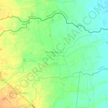
Name: Macalamcam B topographic map, elevation, terrain.

Location: Macalamcam B, Rosario, Batangas, Calabarzon, 4324, Philippines (13.83489 121.30896 13.87489 121.34896)

Average elevation: 45 m

Minimum elevation: 28 m

Maximum elevation: 65 m

Other topographic maps

Click on a map to view its topography, its elevation and its terrain.

Pinagsibaan

Philippines > Batangas > Rosario

Average elevation: 57 m

Gear up for your next adventure:

🚲Bike Repair Kit - Essential tools for on-trail mechanical issues
🔥Camping Stove - Portable stoves to cook outdoors with ease
🥾Trail Running Boots - Durable shoes designed for trail running
🥾Light Trekking Boots - Supportive boots for multi-day treks
🦶Anti-Blister Balm - Prevents friction and hotspots during long ascents

As an Amazon Associate, this site earns from qualifying purchases at no extra cost to you.