Geolocate

Palihan topographic map

Click on the map to display elevation.

About this map

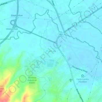
Name: Palihan topographic map, elevation, terrain.

Location: Palihan, Hermosa, Bataan, Central Luzon, 2111, Philippines (14.82608 120.44832 14.86608 120.48832)

Average elevation: 15 m

Minimum elevation: 5 m

Maximum elevation: 72 m

Gear up for your next adventure:

🔭Compact Binoculars - Lightweight optics for scouting trails and wildlife
🍽️Titanium Camping Spork - Ultralight and indestructible eating utensil
🧢Beanie Hat - Keep your head warm in cold weather
🎒Hiking Daypack - Lightweight and durable backpacks for day trips and excursions
🚲Heavy Duty Bike Lock - Secure your bike at the trailhead or during stops

As an Amazon Associate, this site earns from qualifying purchases at no extra cost to you.