Geolocate

Prestwick topographic map

Click on the map to display elevation.

About this map

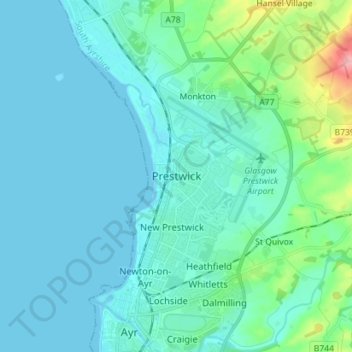
Name: Prestwick topographic map, elevation, terrain.

Location: Prestwick, South Ayrshire, Scotland, KA9 1PA, United Kingdom (55.45828 -4.65130 55.53828 -4.57130)

Average elevation: 18 m

Minimum elevation: -1 m

Maximum elevation: 132 m

Gear up for your next adventure:

👖Convertible Hiking Pants - Zip-off legs to adapt to changing weather conditions
Camping Essentials - All-in-one gear for a comfortable camping trip
🛏️Camping Sleeping Mat - Comfortable mats for sleeping outdoors
🪑Insulated Seat Pad - Protect your seat from cold rocks and wet logs
Backpacking Tent - Lightweight tent for long-distance hiking trips

As an Amazon Associate, this site earns from qualifying purchases at no extra cost to you.