
Thank you for supporting this site ❤️
Make a donation
Make a donation
Gear up for your next adventure:
As an Amazon Associate, this site earns from qualifying purchases at no extra cost to you.
Rejano topographic map
Click on the map to display elevation.
Thank you for supporting this site ❤️
Make a donation
Make a donation
Gear up for your next adventure:
As an Amazon Associate, this site earns from qualifying purchases at no extra cost to you.
About this map
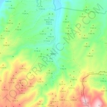
Name: Rejano topographic map, elevation, terrain.
Location: Rejano, Caniles, Comarca de Baza, Granada, Andalusië, Spanje (37.33014 -2.68863 37.37014 -2.64863)
Average elevation: 1,157 m
Minimum elevation: 1,019 m
Maximum elevation: 1,351 m
Thank you for supporting this site ❤️
Make a donation
Make a donation
Gear up for your next adventure:
As an Amazon Associate, this site earns from qualifying purchases at no extra cost to you.