
Thank you for supporting this site ❤️
Make a donation
Make a donation
Gear up for your next adventure:
As an Amazon Associate, this site earns from qualifying purchases at no extra cost to you.
Po-Lem-Sa-Ang topographic map
Click on the map to display elevation.
Thank you for supporting this site ❤️
Make a donation
Make a donation
Gear up for your next adventure:
As an Amazon Associate, this site earns from qualifying purchases at no extra cost to you.
About this map
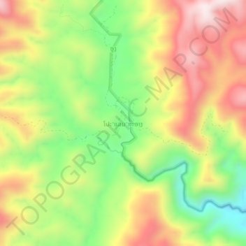
Name: Po-Lem-Sa-Ang topographic map, elevation, terrain.
Location: Po-Lem-Sa-Ang, Kaleum District, Sekong Province, Laos (15.93933 106.80117 15.97933 106.84117)
Average elevation: 740 m
Minimum elevation: 454 m
Maximum elevation: 1,037 m
Thank you for supporting this site ❤️
Make a donation
Make a donation
Gear up for your next adventure:
As an Amazon Associate, this site earns from qualifying purchases at no extra cost to you.