Geolocate

Rocca la Meja topographic map

Click on the map to display elevation.

About this map

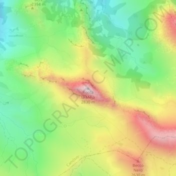
Name: Rocca la Meja topographic map, elevation, terrain.

Location: Rocca la Meja, Canosio, Cuneo, Piemonte, Italia (44.39850 7.06855 44.39860 7.06865)

Average elevation: 2,342 m

Minimum elevation: 1,995 m

Maximum elevation: 2,815 m

Gear up for your next adventure:

🥾Waterproof Trail Shoes - Shoes designed to handle wet terrain
🕯️Camping Lantern - Illuminates your entire campsite with high-efficiency LEDs
🧦Hiking Liner Socks - Thin base layer to prevent friction and blisters
🧥Softshell Hiking Jacket - The perfect balance of wind protection and breathability
🕶️Polarized Sunglasses - Reduces glare from snow and water at high elevations

As an Amazon Associate, this site earns from qualifying purchases at no extra cost to you.