Geolocate

Holy Cross topographic map

Click on the map to display elevation.

About this map

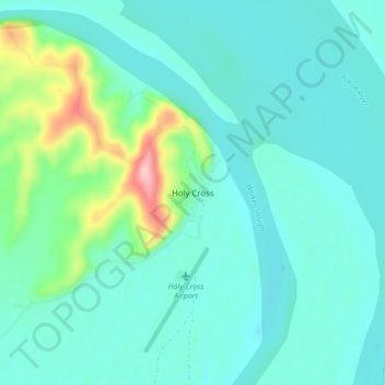
Name: Holy Cross topographic map, elevation, terrain.

Location: Holy Cross, Unorganized Borough, Alaska, United States (62.17944 -159.79139 62.21944 -159.75139)

Average elevation: 33 m

Minimum elevation: 4 m

Maximum elevation: 164 m

Gear up for your next adventure:

🦯Trekking Poles - Reduced impact on joints for steep topographic climbs
🔦LED Headlamp - Hands-free lighting for early morning starts or late finishes
🛶Waterproof Dry Bags - Keep electronics and clothes dry during river crossings
🔋Lithium AA Batteries - Long-lasting power that performs in extreme cold
🌡️Emergency Mylar Blankets - Compact thermal protection for unexpected nights outdoors

As an Amazon Associate, this site earns from qualifying purchases at no extra cost to you.