
Thank you for supporting this site ❤️
Make a donation
Make a donation
Gear up for your next adventure:
As an Amazon Associate, this site earns from qualifying purchases at no extra cost to you.
Pucara topographic map
Click on the map to display elevation.
Thank you for supporting this site ❤️
Make a donation
Make a donation
Gear up for your next adventure:
As an Amazon Associate, this site earns from qualifying purchases at no extra cost to you.
About this map
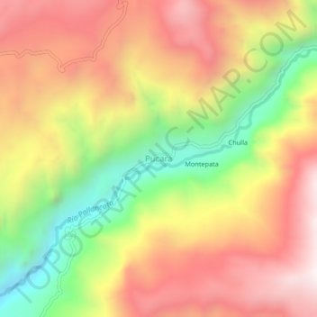
Name: Pucara topographic map, elevation, terrain.
Location: Pucara, Coronel Castañeda, Parinacochas, Ayacucho, Perú (-14.84397 -73.34176 -14.80397 -73.30176)
Average elevation: 3,848 m
Minimum elevation: 3,254 m
Maximum elevation: 4,348 m
Thank you for supporting this site ❤️
Make a donation
Make a donation
Gear up for your next adventure:
As an Amazon Associate, this site earns from qualifying purchases at no extra cost to you.