Geolocate

Corella topographic map

Click on the map to display elevation.

About this map
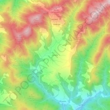
Name: Corella topographic map, elevation, terrain.

Location: Corella, Dicomano, Firenze, Toscana, Italia (43.92055 11.54010 43.96055 11.58010)

Average elevation: 503 m

Minimum elevation: 246 m

Maximum elevation: 776 m

Gear up for your next adventure:

❄️Traction Ice Cleats - Slip-on spikes for icy trails and winter hiking
🥽Outdoor Goggles - Protective eyewear for outdoor activities
🥾Hiking Shoes - Durable and comfortable shoes for trail hiking
🩹Moleskin Blister Pads - Direct protection for painful foot pressure points
👟Leg Gaiters - Keep debris, mud, and snow out of your boots

As an Amazon Associate, this site earns from qualifying purchases at no extra cost to you.