Geolocate

Orlec topographic map

Click on the map to display elevation.

About this map

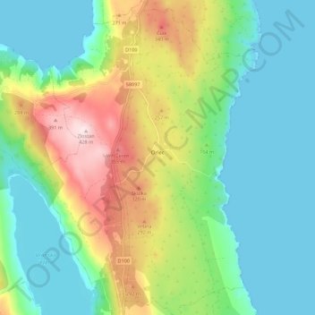
Name: Orlec topographic map, elevation, terrain.

Location: Orlec, Grad Cres, Primorje-Gorski Kotar County, Croatia (44.84111 14.40998 44.91913 14.45894)

Average elevation: 130 m

Minimum elevation: -1 m

Maximum elevation: 425 m

Gear up for your next adventure:

💡Compact LED Flashlight - Powerful and portable flashlight for outdoor use
👟Sport Hiking Sandals - Breathable footwear for water crossings and camp rest
🐕Hiking Dog Pack - Let your canine companion carry their own water and food
🧶550 Survival Paracord - Versatile utility cord for emergency repairs and rigging
🔦LED Flashlight - Powerful and long-lasting flashlight for camping and emergencies

As an Amazon Associate, this site earns from qualifying purchases at no extra cost to you.