Geolocate

Madhogarh topographic map

Click on the map to display elevation.

About this map

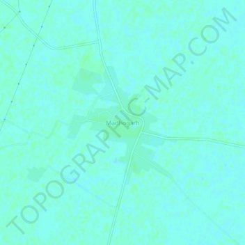
Name: Madhogarh topographic map, elevation, terrain.

Location: Madhogarh, Jalaun, Uttar Pradesh, India (26.25614 79.16623 26.29614 79.20623)

Average elevation: 146 m

Minimum elevation: 144 m

Maximum elevation: 149 m

Gear up for your next adventure:

🥾Trail Running Shoes - Lightweight and durable shoes for trail running
🩹Moleskin Blister Pads - Direct protection for painful foot pressure points
🧴Waterproofing Spray - Restore the DWR coating on jackets and tents
🥾Mountain Hiking Shoes - Shoes with superior grip for mountainous terrain
🩹Compact First Aid Kit - Pre-packed essentials for common trail injuries

As an Amazon Associate, this site earns from qualifying purchases at no extra cost to you.