
Make a donation
Gear up for your next adventure:
As an Amazon Associate, this site earns from qualifying purchases at no extra cost to you.
Mount Porte Crayon topographic map
Click on the map to display elevation.
Make a donation
Gear up for your next adventure:
As an Amazon Associate, this site earns from qualifying purchases at no extra cost to you.
Mount Porte Crayon
Mount Porte Crayon is a mountain in the Roaring Plains Wilderness of the Monongahela National Forest in the northeastern corner of Randolph County, West Virginia, USA. It rises to an elevation of 4,770 feet (1,450 m), the elevational climax of the Allegheny Front. The mountain is named for 19th century writer and illustrator David Hunter Strother (1816–88), known as "Porte Crayon" (French, porte-crayon: "pencil/crayon holder"), who produced a wide array of early West Virginia landscapes in his work.
Make a donation
Gear up for your next adventure:
As an Amazon Associate, this site earns from qualifying purchases at no extra cost to you.
About this map
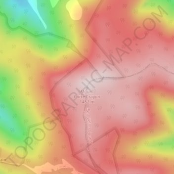
Name: Mount Porte Crayon topographic map, elevation, terrain.
Average elevation: 1,288 m
Minimum elevation: 947 m
Maximum elevation: 1,452 m
Make a donation
Gear up for your next adventure:
As an Amazon Associate, this site earns from qualifying purchases at no extra cost to you.