Geolocate

Rajur topographic map

Click on the map to display elevation.

About this map

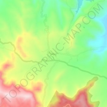
Name: Rajur topographic map, elevation, terrain.

Location: Rajur, Akola, Ahmednagar District, Maharashtra, 422604, India (19.50199 73.84943 19.54199 73.88943)

Average elevation: 760 m

Minimum elevation: 593 m

Maximum elevation: 970 m

Other topographic maps

Click on a map to view its topography, its elevation and its terrain.

Nizampur

India > Maharashtra > Akola

Average elevation: 280 m

Gear up for your next adventure:

Camping Groundsheet - Protect your tent from moisture and dirt
🪑Ultralight Camping Stool - Compact seating for rest stops during long hikes
🧴Bear Spray Holster - Quick-access carry for essential Canadian wilderness safety
Camping Essentials - All-in-one gear for a comfortable camping trip
🧥Ultralight Puffy Jacket - Maximum warmth that packs down to the size of an orange

As an Amazon Associate, this site earns from qualifying purchases at no extra cost to you.