Geolocate

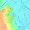
Warraq al Hadar topographic map

Click on the map to display elevation.

About this map

Name: Warraq al Hadar topographic map, elevation, terrain.

Location: Warraq al Hadar, Aj Jiza, 12662, Egypt (30.08083 31.19611 30.12083 31.23611)

Average elevation: 21 m

Minimum elevation: 6 m

Maximum elevation: 33 m

Other topographic maps

Click on a map to view its topography, its elevation and its terrain.

Al Ayat City

Egypt > Aj Jiza

Average elevation: 23 m

Geziret el Dahab

Egypt > Aj Jiza > Giza

Average elevation: 23 m

Nazlet Al Siman and Al Sisi

Egypt > Aj Jiza > Giza

Average elevation: 42 m

Memphis

Egypt > Aj Jiza > Mit Rahinah

Average elevation: 23 m

Gear up for your next adventure:

🔨Vehicle Emergency Tool - Safety tool for remote road trips to trailheads
⛺Lightweight Camping Tent - Portable shelter optimized for Canadian backcountry camping
🥾Trail Hiking Socks - Comfortable socks to prevent blisters and fatigue
🥾Light Trekking Boots - Supportive boots for multi-day treks
🧴Waterproofing Spray - Restore the DWR coating on jackets and tents

As an Amazon Associate, this site earns from qualifying purchases at no extra cost to you.