Geolocate

Pedrissa topographic map

Click on the map to display elevation.

About this map

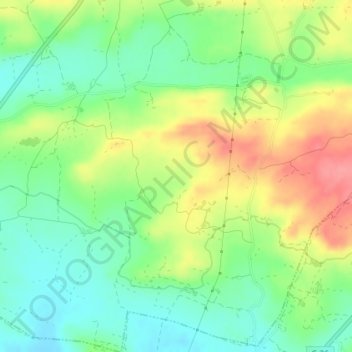
Name: Pedrissa topographic map, elevation, terrain.

Location: Pedrissa, Camarasa, Noguera, Lérida, Cataluña, 25613, España (41.82107 0.86436 41.84107 0.88436)

Average elevation: 292 m

Minimum elevation: 258 m

Maximum elevation: 340 m

Gear up for your next adventure:

🥤Collapsible Travel Cup - Saves space and weight in your mess kit
🧥Waterproof Hiking Jacket - Protect yourself from rain and wind while hiking
💧Filtered Water Bottle - Safe drinking water on the go
🚲Bike Repair Kit - Essential tools for on-trail mechanical issues
🥘Camping Cookware Set - Compact nesting pots and pans for trail cooking

As an Amazon Associate, this site earns from qualifying purchases at no extra cost to you.