Geolocate

Scharbeutz topographic map

Click on the map to display elevation.

About this map

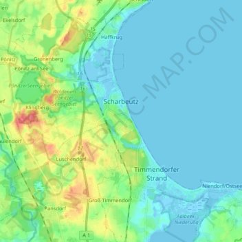
Name: Scharbeutz topographic map, elevation, terrain.

Location: Scharbeutz, Ostholstein, Schleswig-Holstein, Germany (53.97641 10.61112 54.06116 10.77309)

Average elevation: 14 m

Minimum elevation: -4 m

Maximum elevation: 61 m

Gear up for your next adventure:

🔦LED Flashlight - Powerful and long-lasting flashlight for camping and emergencies
🥾Trekking Poles - Adjustable trekking poles to reduce knee stress and improve stability
🦯Trekking Poles - Reduced impact on joints for steep topographic climbs
🥽Outdoor Goggles - Protective eyewear for outdoor activities
🧦Hiking Socks - Moisture-wicking and comfortable socks for long hikes

As an Amazon Associate, this site earns from qualifying purchases at no extra cost to you.