Geolocate

Innes Park topographic map

Click on the map to display elevation.

About this map

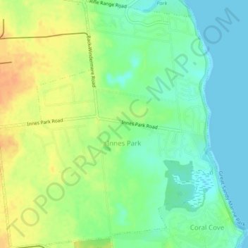
Name: Innes Park topographic map, elevation, terrain.

Location: Innes Park, Bundaberg Region, Queensland, Australia (-24.88529 152.44817 -24.84865 152.48436)

Average elevation: 15 m

Minimum elevation: 0 m

Maximum elevation: 34 m

Other topographic maps

Click on a map to view its topography, its elevation and its terrain.

Gear up for your next adventure:

🧢Hiking Hat - Sun-protective and breathable hats for long treks
🔦LED Headtorch - Bright and durable light for night activities
🥾Mountaineering Boots - Supportive boots for climbing and high-altitude hiking
🧴Outdoor Sunscreen - High SPF protection for high-altitude UV exposure
🌡️Emergency Mylar Blankets - Compact thermal protection for unexpected nights outdoors

As an Amazon Associate, this site earns from qualifying purchases at no extra cost to you.