Geolocate

Palili topographic map

Click on the map to display elevation.

About this map

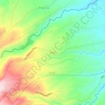
Name: Palili topographic map, elevation, terrain.

Location: Palili, Samal, Bataan, Central Luzon, 2113, Philippines (14.73197 120.43570 14.77197 120.47570)

Average elevation: 262 m

Minimum elevation: 124 m

Maximum elevation: 476 m

Gear up for your next adventure:

💡LED Camping Lantern - Illuminate your campsite with long-lasting lanterns
🔦LED Flashlight - Powerful and long-lasting flashlight for camping and emergencies
🥾Hiking Shoes - Durable and comfortable shoes for trail hiking
🥫Freeze-Dried Meals - Lightweight, high-calorie nutrition for multi-day treks
🥾All-Terrain Hiking Boots - Versatile boots for varied hiking conditions

As an Amazon Associate, this site earns from qualifying purchases at no extra cost to you.