
Cacaban topographic map
Click on the map to display elevation.
About this map
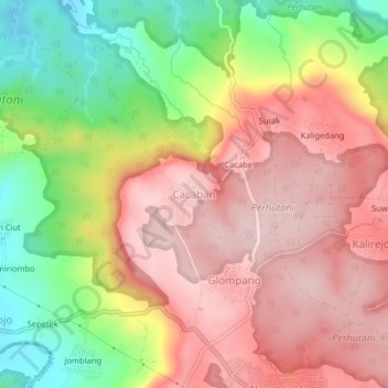
Name: Cacaban topographic map, elevation, terrain.
Location: Cacaban, Kendal, Central Java, Java, Indonesia (-7.08418 110.18841 -7.04418 110.22841)
Average elevation: 230 m
Minimum elevation: 70 m
Maximum elevation: 348 m
Other topographic maps
Click on a map to view its topography, its elevation and its terrain.
Taman Kantor Kecamatan Kaliwungu
Indonesia > Central Java > Kendal > Kendal > Sikopek Kulon
Average elevation: 8 m
Taman Alun-Alun Kaliwungu
Indonesia > Central Java > Kendal > Kendal > Sikopek Kulon
Average elevation: 15 m