
Canton topographic map
Click on the map to display elevation.
About this map
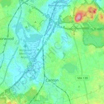
Name: Canton topographic map, elevation, terrain.
Location: Canton, Norfolk County, Massachusetts, 02021, United States (42.13770 -71.17804 42.22791 -71.06662)
Average elevation: 44 m
Minimum elevation: 8 m
Maximum elevation: 189 m
Other topographic maps
Click on a map to view its topography, its elevation and its terrain.
Lake Mirimichi Dam
United States > Massachusetts > Norfolk County > Foxborough
Average elevation: 52 m