Geolocate

Eastpoint topographic map

Click on the map to display elevation.

About this map

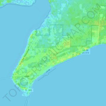
Name: Eastpoint topographic map, elevation, terrain.

Location: Eastpoint, Franklin County, Florida, United States (29.72233 -84.91591 29.78168 -84.83232)

Average elevation: 2 m

Minimum elevation: -5 m

Maximum elevation: 13 m

Other topographic maps

Click on a map to view its topography, its elevation and its terrain.

Gear up for your next adventure:

🥾Durable Hiking Shoes - Long-lasting shoes for frequent hiking
🧤Insulated Winter Gloves - Heavy-duty protection for sub-zero Canadian adventures
🔭Outdoor Binoculars - Lightweight binoculars for birdwatching and hiking
🥾Trail Hiking Shoes - Durable shoes designed for rugged trails
💧Hydration Pack - Hands-free hydration system for long hikes

As an Amazon Associate, this site earns from qualifying purchases at no extra cost to you.