Geolocate

Gurmul topographic map

Click on the map to display elevation.

About this map

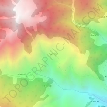
Name: Gurmul topographic map, elevation, terrain.

Location: Gurmul, Doda, Jammu and Kashmir, 182145, India (33.18500 75.41161 33.22500 75.45161)

Average elevation: 2,312 m

Minimum elevation: 1,323 m

Maximum elevation: 3,278 m

Gear up for your next adventure:

👟Trail Running Shoes - Agile footwear for fast-paced topographic exploration
🧤Insulated Winter Gloves - Heavy-duty protection for sub-zero Canadian adventures
🛁Quick-Dry Microfiber Towel - Space-saving towel that dries rapidly on the move
🧴Bear Spray Holster - Quick-access carry for essential Canadian wilderness safety
🧥Waterproof Jacket - Lightweight rain jackets for hiking and outdoor activities

As an Amazon Associate, this site earns from qualifying purchases at no extra cost to you.