Geolocate

Matamata topographic map

Click on the map to display elevation.

About this map

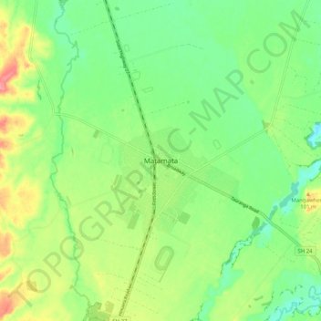
Name: Matamata topographic map, elevation, terrain.

Location: Matamata, Matamata Piako District, Waikato, 3400, New Zealand (-37.84956 175.73328 -37.76956 175.81328)

Average elevation: 67 m

Minimum elevation: 35 m

Maximum elevation: 119 m

Other topographic maps

Click on a map to view its topography, its elevation and its terrain.

Gear up for your next adventure:

🛌Insulated Sleeping Pad - Critical thermal barrier between you and the cold ground
🥾Trail Hiking Boots - Supportive boots for rough trails
🥾Trail Running Shoes - Lightweight and durable shoes for trail running
💡LED Headlamp - Hands-free illumination for night hiking and camping
🧢Hiking Hat - Sun-protective and breathable hats for long treks

As an Amazon Associate, this site earns from qualifying purchases at no extra cost to you.