Geolocate

Marquesado topographic map

Click on the map to display elevation.

About this map

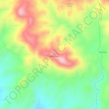
Name: Marquesado topographic map, elevation, terrain.

Location: Marquesado, Otzoloapan, State of Mexico, Mexico (19.06401 -100.29806 19.06411 -100.29796)

Average elevation: 1,222 m

Minimum elevation: 1,102 m

Maximum elevation: 1,359 m

Gear up for your next adventure:

🧊Portable Cooler - Keep food and drinks cold during outdoor adventures
🔦UV Flashlight - Detect minerals or specific insects in the dark
🚲Handlebar Phone Mount - View topographic-map.com live while cycling
🐕Hiking Dog Pack - Let your canine companion carry their own water and food
🧤Thermal Hiking Gloves - Grip-enhanced gloves for cold-weather altitude trekking

As an Amazon Associate, this site earns from qualifying purchases at no extra cost to you.