Geolocate

Muruhuay topographic map

Click on the map to display elevation.

About this map

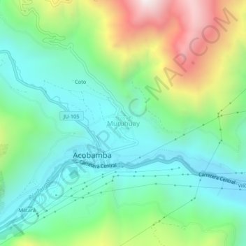
Name: Muruhuay topographic map, elevation, terrain.

Location: Muruhuay, Acobamba, Tarma, Junín, Perú (-11.36737 -75.67421 -11.32737 -75.63421)

Average elevation: 3,273 m

Minimum elevation: 2,901 m

Maximum elevation: 4,118 m

Gear up for your next adventure:

🪑Insulated Seat Pad - Protect your seat from cold rocks and wet logs
🥾Trail Hiking Boots - Supportive boots for rough trails
🥾Hiking Gaiters - Protect legs and shoes from mud, snow, and debris
🧦Thermal Socks - Warm socks for winter hiking or camping
🔦LED Flashlight - Powerful and long-lasting flashlight for camping and emergencies

As an Amazon Associate, this site earns from qualifying purchases at no extra cost to you.