Geolocate

Sostino topographic map

Click on the map to display elevation.

About this map

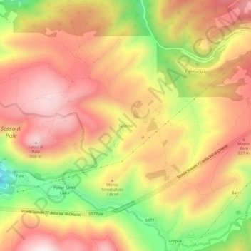
Name: Sostino topographic map, elevation, terrain.

Location: Sostino, Foligno, Perugia, Umbria, 06034, Italy (42.97114 12.77825 43.01114 12.81825)

Average elevation: 706 m

Minimum elevation: 330 m

Maximum elevation: 968 m

Gear up for your next adventure:

🧭GPS Outdoor Watch - Smart watch for navigation and fitness tracking in nature
👟Trail Running Shoes - Agile footwear for fast-paced topographic exploration
🥾Trail Hiking Boots - Supportive boots for rough trails
🥾Lightweight Hiking Shoes - Comfortable shoes for day hikes
🕶️Polarized Sunglasses - Protect your eyes with durable polarized lenses

As an Amazon Associate, this site earns from qualifying purchases at no extra cost to you.