Geolocate

Los Frailes topographic map

Click on the map to display elevation.

About this map

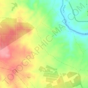
Name: Los Frailes topographic map, elevation, terrain.

Location: Los Frailes, Lepe, Costa Occidental, Huelva, Andalusia, Spain (37.33859 -7.27794 37.35859 -7.25794)

Average elevation: 84 m

Minimum elevation: 33 m

Maximum elevation: 134 m

Gear up for your next adventure:

💡Solar Camping Lamp - Eco-friendly lighting for campsites
Camping Tent - Weather-resistant tents suitable for 2 to 6 people
🍽️Titanium Camping Spork - Ultralight and indestructible eating utensil
💧Hydration Pack - Hands-free hydration system for long hikes
🥤Collapsible Travel Cup - Saves space and weight in your mess kit

As an Amazon Associate, this site earns from qualifying purchases at no extra cost to you.