
Xining topographic map
Click on the map to display elevation.
Xining
The city was a commercial hub along the Northern Silk Road's Hexi Corridor for over 2000 years, and was a stronghold of the Han, Sui, Tang, and Song dynasties' resistance against nomadic attacks from the west. Although long a part of Gansu province, Xining was added to Qinghai in 1928. Xining holds sites of religious significance to Muslims and Buddhists, including the Dongguan Mosque and Ta'er Monastery. The city lies in the Huangshui River valley, and owing to its high altitude, has a cool climate on the borderline between cool semi-arid and dry winter humid continental. It is connected by rail to Lhasa, Tibet and connected by high-speed rail to Lanzhou, Gansu and Ürümqi, Xinjiang.
About this map
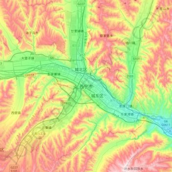
Name: Xining topographic map, elevation, terrain.
Average elevation: 2,505 m
Minimum elevation: 2,140 m
Maximum elevation: 2,969 m