
Thank you for supporting this site ❤️
Make a donation
Make a donation
Gear up for your next adventure:
As an Amazon Associate, this site earns from qualifying purchases at no extra cost to you.
Ringelspitz topographic map
Click on the map to display elevation.
Thank you for supporting this site ❤️
Make a donation
Make a donation
Gear up for your next adventure:
As an Amazon Associate, this site earns from qualifying purchases at no extra cost to you.
About this map
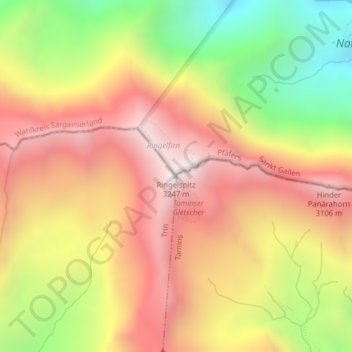
Name: Ringelspitz topographic map, elevation, terrain.
Location: Ringelspitz, Trin, Imboden, Grisons, Switzerland (46.89828 9.34301 46.89838 9.34311)
Average elevation: 2,628 m
Minimum elevation: 1,909 m
Maximum elevation: 3,205 m
Thank you for supporting this site ❤️
Make a donation
Make a donation
Gear up for your next adventure:
As an Amazon Associate, this site earns from qualifying purchases at no extra cost to you.