
Make a donation
Gear up for your next adventure:
As an Amazon Associate, this site earns from qualifying purchases at no extra cost to you.
Dreiherrnspitze topographic map
Click on the map to display elevation.
Make a donation
Gear up for your next adventure:
As an Amazon Associate, this site earns from qualifying purchases at no extra cost to you.
Dreiherrnspitze
Im 16. Jahrhundert wurde der Gipfel auch Dreyerherrenspitz, bis 1873 auch Dreiländer genannt, weil an dieser Stelle die Herrschaftsgebiete der Grafen von Tirol, der Grafen von Görz, sowie der Fürstbischöfe von Salzburg aneinanderstießen. An der Dreiherrnspitze zweigt nach Südwesten der Rosshufkamm ab. Sie hat einen östlichen Hauptgipfel und einen Westgipfel mit 3418 Metern Höhe. Über beide Vermessungspunkte verläuft auf dem Verbindungsgrat die Grenze. Nach Nordosten besitzt der Berg eine teilweise vereiste, 450 Meter hohe und über 60° geneigte Nordostwand.
Make a donation
Gear up for your next adventure:
As an Amazon Associate, this site earns from qualifying purchases at no extra cost to you.
About this map
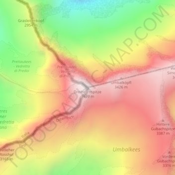
Name: Dreiherrnspitze topographic map, elevation, terrain.
Average elevation: 2,951 m
Minimum elevation: 2,306 m
Maximum elevation: 3,460 m
Make a donation
Gear up for your next adventure:
As an Amazon Associate, this site earns from qualifying purchases at no extra cost to you.