Geolocate

Hustle topographic map

Click on the map to display elevation.

About this map

Name: Hustle topographic map, elevation, terrain.

Location: Hustle, Essex County, Virginia, 22476, United States (38.02263 -77.08942 38.06263 -77.04942)

Average elevation: 41 m

Minimum elevation: 9 m

Maximum elevation: 58 m

Other topographic maps

Click on a map to view its topography, its elevation and its terrain.
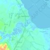
Tappahannock

United States > Virginia > Essex County

Average elevation: 6 m

Gear up for your next adventure:

🧥Waterproof Hiking Jacket - Protect yourself from rain and wind while hiking
⛺Family Camping Tent - Spacious tent suitable for family camping trips
🥾Approach Shoes - Shoes designed for climbing approaches and rugged trails
🧼Biodegradable Camp Soap - Environmentally friendly cleaning for gear and body
🛏️Sleeping Bag - Warm and compact sleeping bags for outdoor camping

As an Amazon Associate, this site earns from qualifying purchases at no extra cost to you.