
Thank you for supporting this site ❤️
Make a donation
Make a donation
Gear up for your next adventure:
As an Amazon Associate, this site earns from qualifying purchases at no extra cost to you.
Villaro topographic map
Click on the map to display elevation.
Thank you for supporting this site ❤️
Make a donation
Make a donation
Gear up for your next adventure:
As an Amazon Associate, this site earns from qualifying purchases at no extra cost to you.
About this map
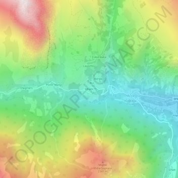
Name: Villaro topographic map, elevation, terrain.
Location: Villaro, Acceglio, Cuneo, Piemonte, 12021, Italia (44.45612 6.95672 44.49612 6.99672)
Average elevation: 1,750 m
Minimum elevation: 1,175 m
Maximum elevation: 2,694 m
Thank you for supporting this site ❤️
Make a donation
Make a donation
Gear up for your next adventure:
As an Amazon Associate, this site earns from qualifying purchases at no extra cost to you.