Geolocate

Lijing topographic map

Click on the map to display elevation.

About this map

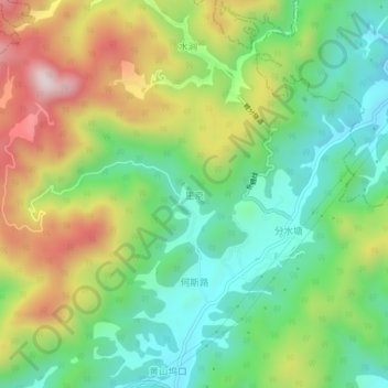
Name: Lijing topographic map, elevation, terrain.

Location: Lijing, Jinhua, Zhejiang, China (29.33501 119.92917 29.37501 119.96917)

Average elevation: 345 m

Minimum elevation: 128 m

Maximum elevation: 695 m

Gear up for your next adventure:

🔦UV Flashlight - Detect minerals or specific insects in the dark
🧴Insect Repellent - Protect yourself from bugs during outdoor adventures
🗺️Topographic Maps - Detailed maps to explore trails, mountains, and wilderness areas
🎒Hiking Backpack - Lightweight and ergonomic backpacks for day hikes or multi-day treks
🥾Waterproof Trail Shoes - Shoes designed to handle wet terrain

As an Amazon Associate, this site earns from qualifying purchases at no extra cost to you.