
Collado Palmir topographic map
Interactive map
Click on the map to display elevation.
About this map
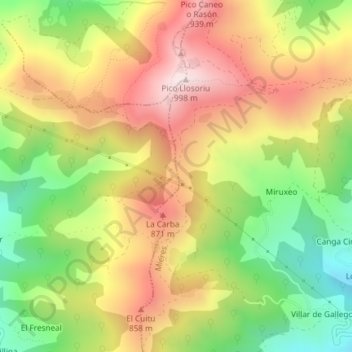
Name: Collado Palmir topographic map, elevation, terrain.
Location: Collado Palmir, Riosa, Asturias, 33160, España (43.23033 -5.84377 43.23043 -5.84367)
Average elevation: 675 m
Minimum elevation: 359 m
Maximum elevation: 985 m
Other topographic maps
Click on a map to view its topography, its elevation and its terrain.