Geolocate

Forest topographic map

Click on the map to display elevation.

About this map
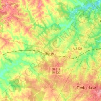
Name: Forest topographic map, elevation, terrain.

Location: Forest, Bedford County, Virginia, 24551, United States (37.31706 -79.34234 37.41619 -79.23274)

Average elevation: 257 m

Minimum elevation: 196 m

Maximum elevation: 319 m

Gear up for your next adventure:

🚲MTB Frame Bag - Carry tools and maps directly on your bicycle frame
🩹Compact First Aid Kit - Pre-packed essentials for common trail injuries
🔭Outdoor Binoculars - Lightweight binoculars for birdwatching and hiking
🔭Compact Monocular - One-handed bird watching and trail spotting
⛺Family Camping Tent - Spacious tent suitable for family camping trips

As an Amazon Associate, this site earns from qualifying purchases at no extra cost to you.